Formation of Mt. Myogi
The volcanic activity that formed Mt. Myogi began approximately 6 million years ago. In comparison, Mt. Fuji started its volcanic activity around 400,000 years ago, making Mt. Myogi a much older volcano.
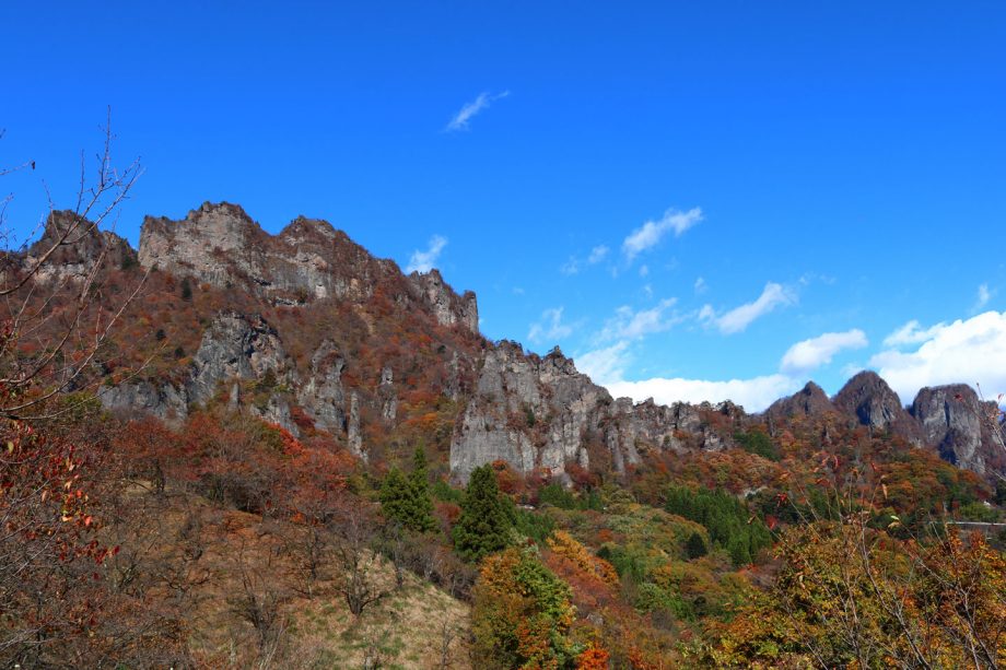
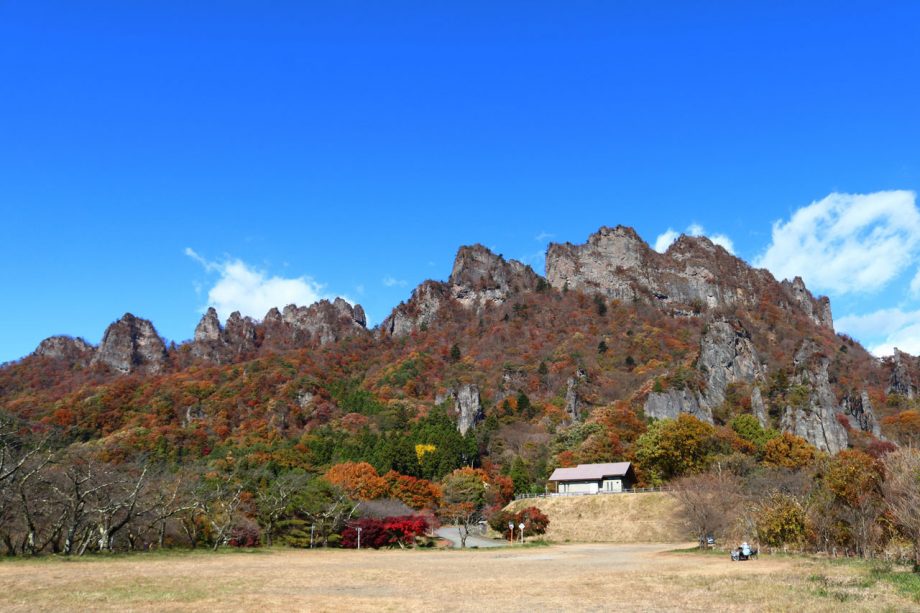
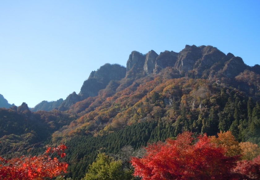
Most volcanoes become inactive after 1 to 2 million years of activity. While Mt. Fuji is still considered active, Mt. Myogi’s volcanic activity ended long ago. Over millions of years, the mountain has been eroded by wind and rain, shaping its current dramatic and unusual form. Today, it is known as one of the Three Great Strange Scenic Spots of Japan.
It’s possible that Mt. Myogi once looked like Mt. Fuji before erosion transformed it. However, much about the mountain’s geological history remains a mystery. Many older volcanoes have completely eroded away, yet Mt. Myogi has retained its mountainous form—something geologists still can’t fully explain. The origin of its uniquely shaped rock formations also remains one of its many unsolved mysteries.
Basic information about Mt. Myogi
Mt. Myogi was formed by volcanic activity up to about 3 million years ago. It is composed of lava, tuff, and conglomerate rock. Over time, sedimentary layers were eroded, revealing massive outcrops of lava rock.
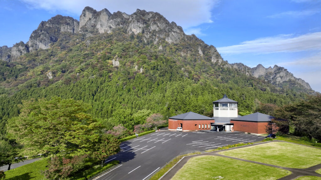
Midway up the mountain sits Myogi Shrine, a solemn and sacred site that worships Mt. Hakuun (Shirakumo-yama) as a deity. During the Edo period, the shrine was believed to protect against fires and lightning. The mountain’s jagged rock peaks and steep cliffs create a dramatic and captivating landscape that leaves a lasting impression on all who visit.
Mt. Myogi is located in Gunma Prefecture and spans three municipalities: Annaka City, Tomioka City, and Shimonita Town. Along with Mt. Akagi and Mt. Haruna, it is one of the Three Famous Mountains of Jōmō (an old name for the Gunma region). It has long been regarded as a sacred mountain.
Highest Peak: Mt. Sōmadake (1,104 m), located on Mt. Hakuun
Other Notable Peak: Mt. Kondō East Peak (1,094 m)
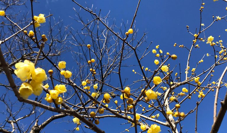
Visitors can enjoy seasonal scenery year-round, from cherry blossoms in spring to vibrant foliage in autumn.
Access to Mt. Myogi
Two main entrances to Mt. Myogi: Nakano-take Shrine and Myogi Shrine.
From the Tokyo Metropolitan Area (by public transportation)
(1) Via JR Line: Take the Shinkansen to Takasaki. Transfer to the Shinetsu Line and get off at Yokogawa Station. Taxi to Myogi Shrine: approx. 25 minutes.
(2) Via JR + Joshin Dentetsu Line: Take the Shinkansen to Takasaki. Transfer to Jyoshin Dentetsu Railway and get off at Shimonita Station. Take a local bus to Nakamura (60 min on foot from there) or take a taxi.
From Gunma Prefecture
From Tomioka Station: Ride-share taxi from Joshin Dentetsu Tomioka Station: approx. 30 minutes to Myogi Shrine.
From JR Yokogawa Station: Taxi: approx. 30 minutes to Myogi Shrine.
Joshin Dentetsu Railway: Bus to Nakamura, then 60 minutes on foot (taxi service also available)
By car
From Fujioka JCT on the Kan-Etsu Expressway, take the Joshin-Etsu Expressway.
Exit at Shimonita IC or Matsuida-Myogi IC: approx. 25 minutes to Mt. Myogi.
From Karuizawa (by taxi)
Taxi from Karuizawa Station: approx. ¥10,000–12,000 per car
(Check with the taxi company for exact rates)
Alternatively, take a JR Bus to Yokokawa Station (approx. 45 minutes)
From Yokokawa: taxi approx. ¥5,000–7,000 per car
Weather in the Mt. Myogi Area (Shimonita Town)
Average Annual Temperature: 12.1°C
Annual Rainfall: 1,546 mm
Snowfall: Occurs 2–3 times a year, generally mild
https://ja.climate-data.org/アシア/日本/群馬県/ Shimoniida-cho-54030/
Mt. Myogi Sightseeing Spot
Abuta Fukujusō Park
Nestled at the foot of Mt. Myōgi, the Abuta Fukujusō Park is located on the terraced slopes of the N...
View Details
Prefectural Forest Park – Sakura no Sato
Located at the foot of the southern face of Mt. Myogi, This park is reminiscent of Shangri-La with a...
View Details
Megane Bridge
Popularly known as "Megane Bridge," it is the largest brick arch bridge in Japan with a diameter of ...
View Details
Nakakan-dō & Stone Gate Path
Mt. Myogi, located within the Myogi-Arafune-Saku Kogen Quasi-National Park, spans both Gunma and Nag...
View Details
Myogi Shrine
Myogi Shrine is located at the eastern foot of Mt. Hakuun, the main peak of Mt. Myogi, a mountain fa...
View Details
Myogi Mountain Panorama Park
Located at the foot of Myogi Mountain, one of Japan's three great scenic wonders, this park offers b...
View Details
Nakano-take Shrine
Nakano-take Shrine was originally established by the Myogata clan during the reign of Emperor Kinmei...
View Details