
Shimonita Geopark
Rootless Mountains of Japan’s Origins
Welcome to Shimonita
Shimonita Geopark is home to a variety of uniquely shaped mountains—each with its own geological story. These mountains did not all form in the same way; instead, they each have a distinct history. In particular, the mountains known as Rootless Mountain – Nenashiyama (Atogura Klippe), which can be seen from the town center, are geologically unusual: the rocks at the top and bottom differ, and it’s believed that the upper layers were transported from afar and thrust on top of the lower ones long ago.
The cause of this dramatic geological event remains a mystery, and since these mountains may hold clues to the birth of the Japanese archipelago, the theme of our geopark is:
“Rootless Mountain: Unlocking the Birth of the Japanese Archipelago.”
In addition to Rootless Mountain, you’ll also find signs of ancient volcanic activity in the striking peaks of Mt. Arafune and Mt. Myogi, which date back 9 to 6 million years. The Median Tectonic Line, one of Japan’s major fault zones, also runs through the center of town. These features all serve as evidence of the dynamic tectonic activity that shaped the Japanese islands as we know them today.
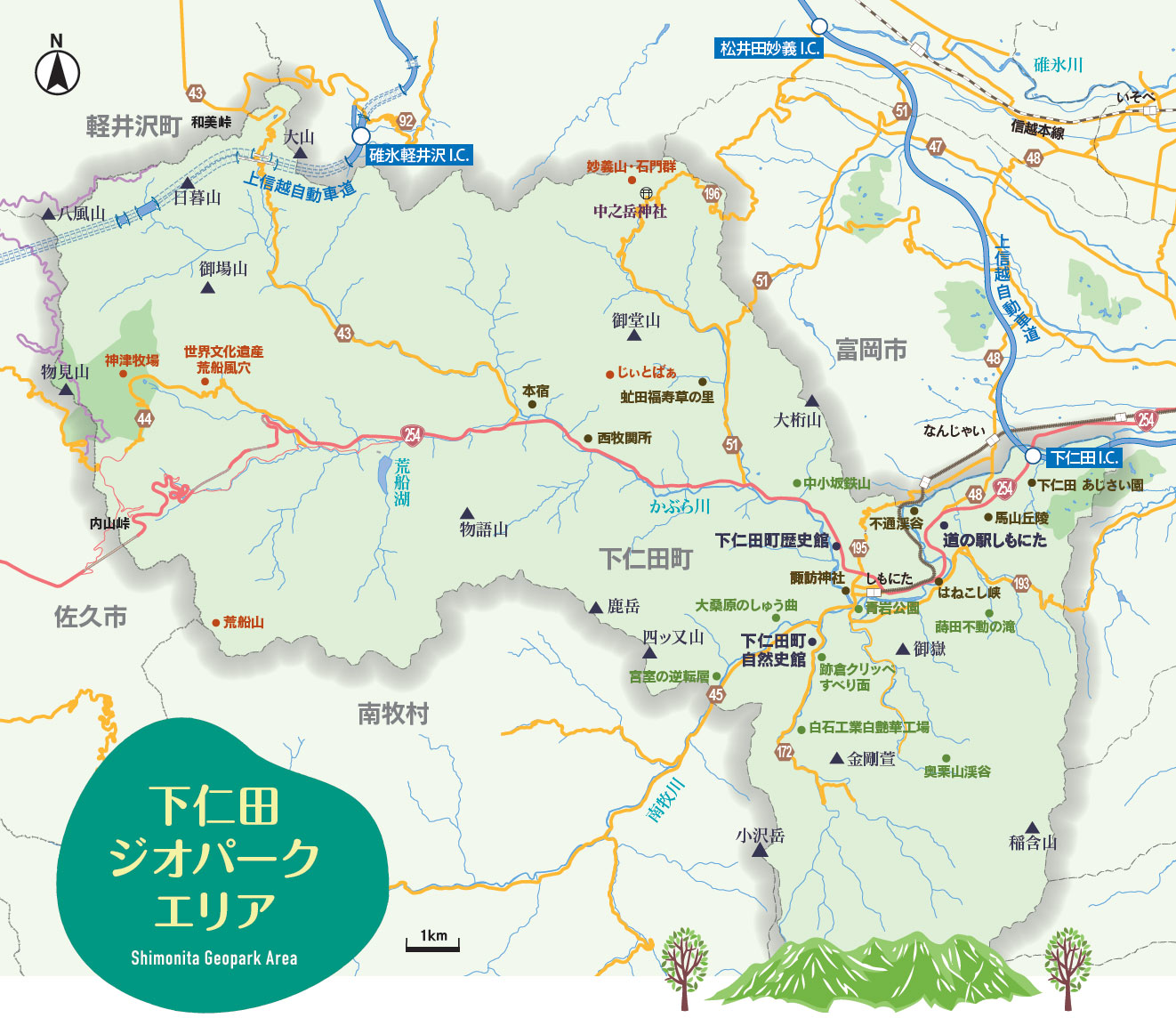
Over time, the people of Shimonita have built their lives by making use of the region’s underground resources and its unique landscape. Within the Geopark, you can find many historical sites such as the Arafune Wind Cave, a UNESCO World Heritage Site, as well as former mining areas and the remains of waterwheels once used for konjac powder production.
Shimonita Geopark is full of fascinating highlights—not just to see, but to truly experience. We invite you to listen to the stories told by local guides and to enjoy gourmet dishes made with the blessings of the land.
— from the official Shimonita Geopark website