
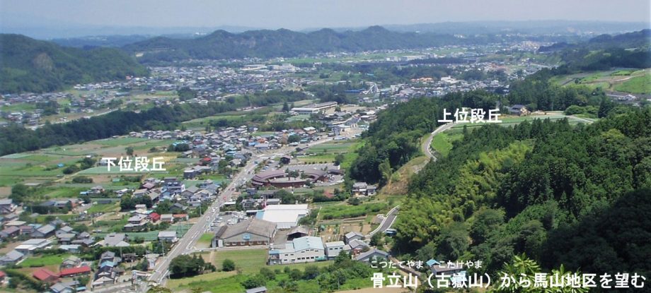
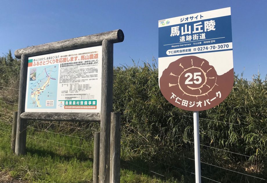
Mayama Course
Shimonita Geopark Guidebook
Welcome to Shimonita Town
On both sides of the river near the “Michi-no-Eki Shimonita” (Roadside Station Shimonita), you’ll find widespread terrace landforms (dankyū chikei, step-like terrain formed by river erosion).
In ancient times, people lived on the upper river terraces (jōi dankyūmen), which offered wide visibility for hunting. As agriculture developed, they moved to the lower terraces (kai dankyūmen), which were closer to water sources.
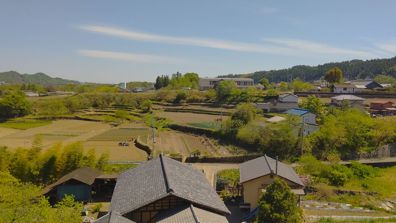
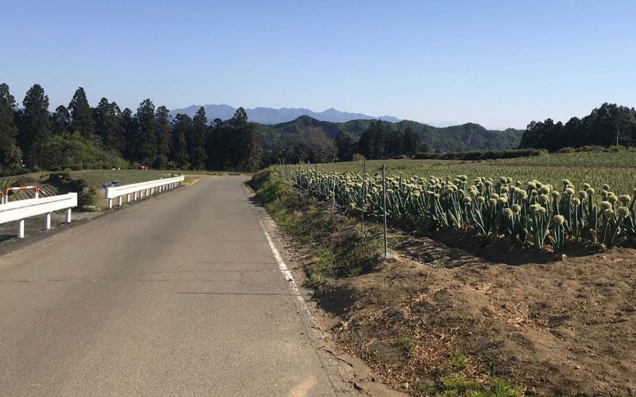
Today, fields of Shimonita’s famous agricultural products, such as Shimonita Negi and konjac, spread across these upper and lower terraces. In early summer, hydrangeas lovingly cultivated by local volunteers from the “Hydrangea Nurturing Group” beautifully decorate the terrace slopes.
Near the Shimonita IC (Interchange) of the Joshinetsu Expressway, a rare earring of foreign origin dating back around 7,000 years was unearthed—evidence that Shimonita has had active exchanges with other regions since ancient times.
Let’s set off from “Michi-no-Eki Shimonita” and take a stroll through the highlights of the Mayama district.
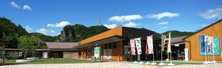
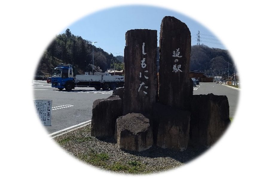
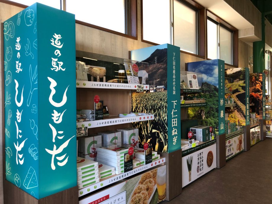
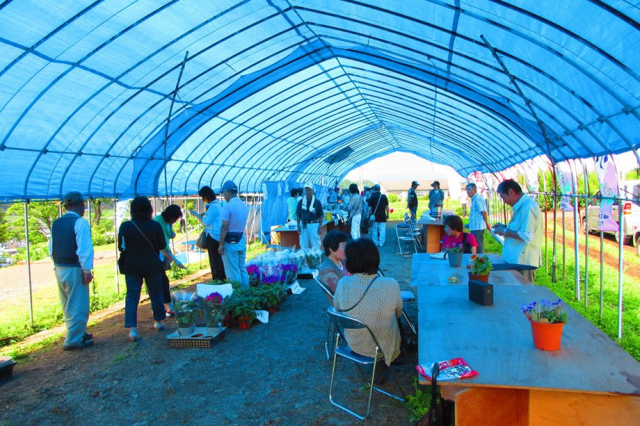
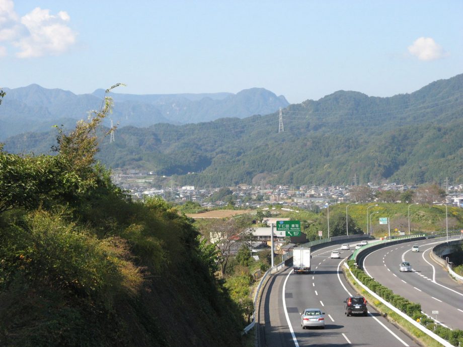
1. Michi-no-Eki Shimonita (Roadside Station Shimonita)
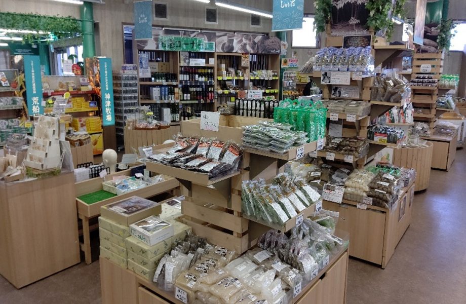
Located about five minutes from the Shimonita Interchange on the Joshinetsu Expressway, this roadside station offers a variety of local specialty products and fresh vegetables. It also serves as a tourist information hub for the Nishi-Jōshū region, with the Shimonita Town Tourist Information Center located on site.
Restrooms and a fast-charging station for electric vehicles are available on the premises 24 hours a day.

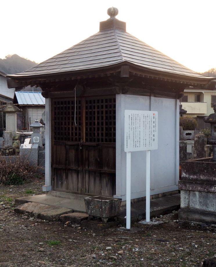
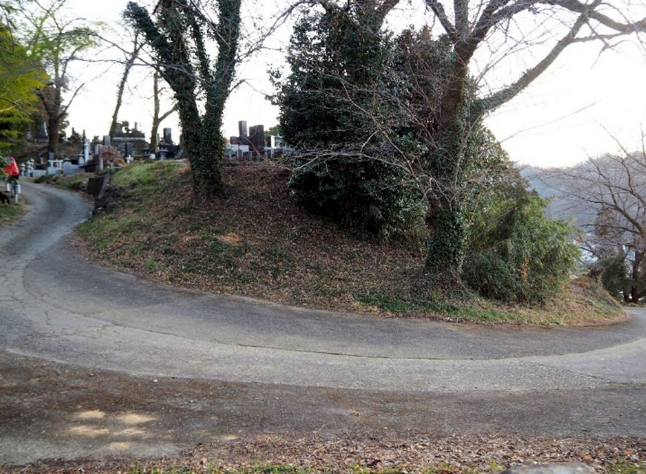
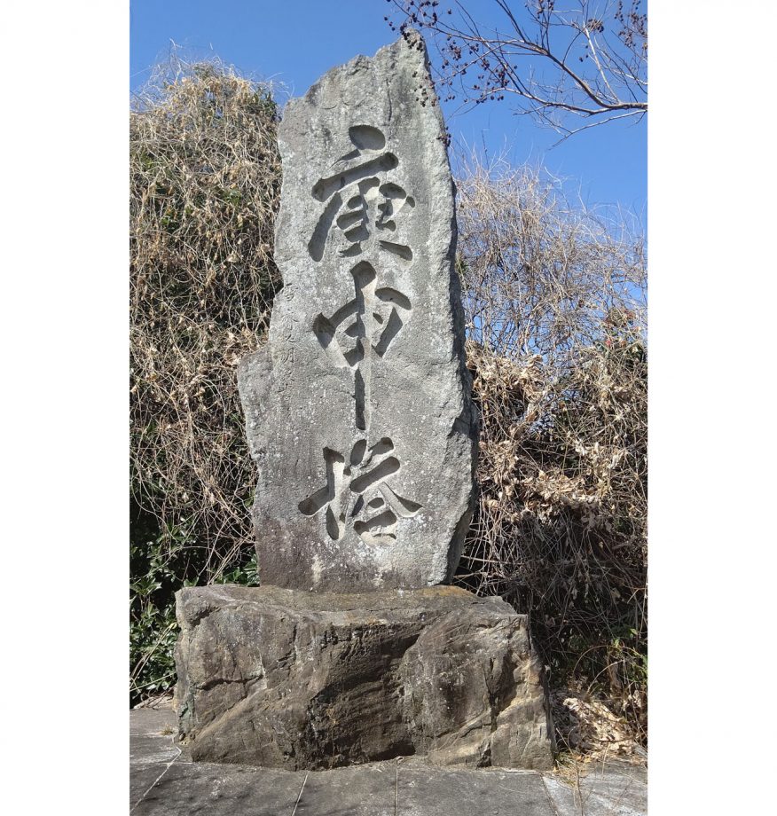
2. Anrakuji Itabi (Stone Monument)
A small hall stands in a graveyard along a narrow road just north of the Anrakuji traffic light. Inside is an old itabi (stone monument) dating back to 1368.
Itabi are flat, stone steles built during the Kamakura and Muromachi periods, often serving as memorial towers or gravestones.
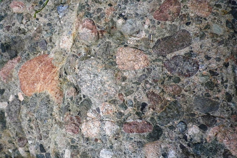
The stone used for this itabi is a type of green schist (known in Japanese as ryokushoku hengan).
The Hall and the Itabi Stone Monument
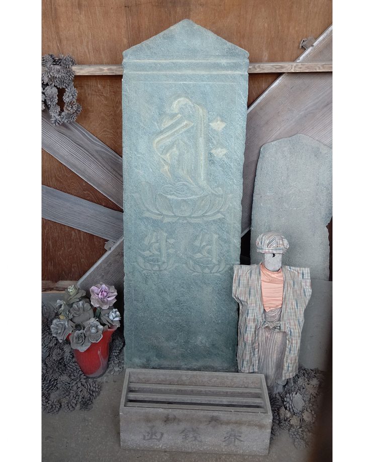
Green Schist
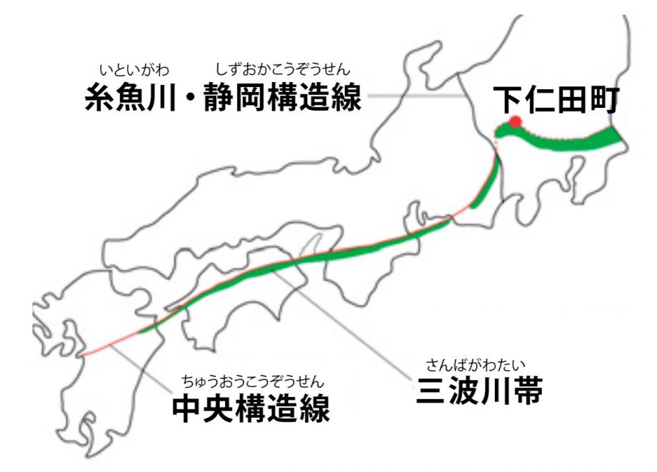
Itabi are thin, flat stone monuments. The green schist found in the Sanbagawa(also spelled Sambagawa) Belt, which stretches from northern Saitama to southern Gunma within the Kanto Mountains, is known as Sanbaseki (Sanba stone).
This stone was widely used in Jomon period stone rods and medieval itabi.
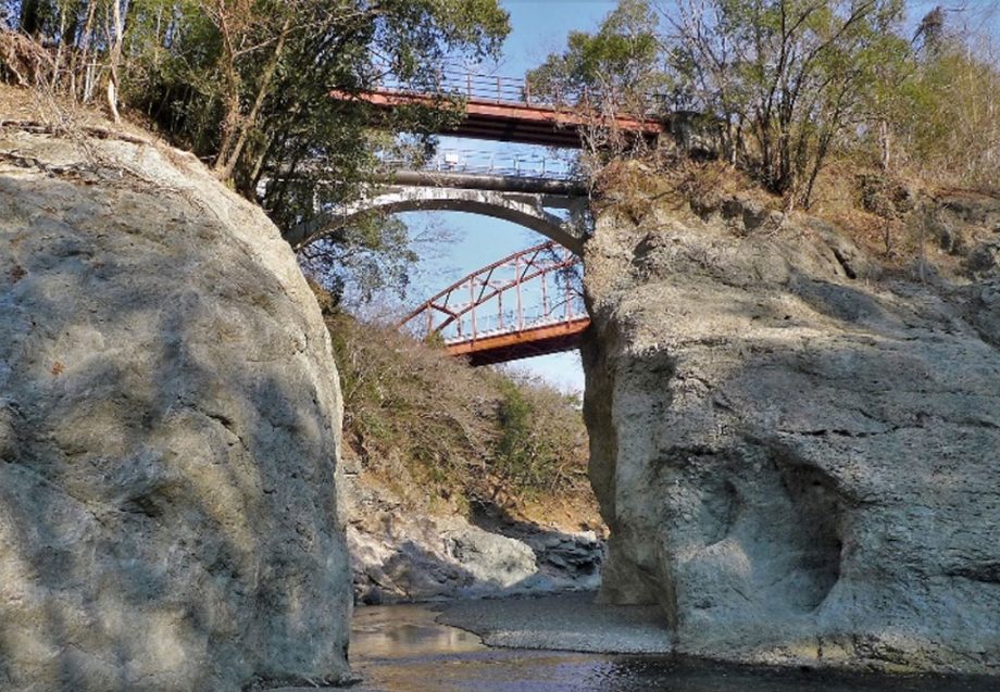
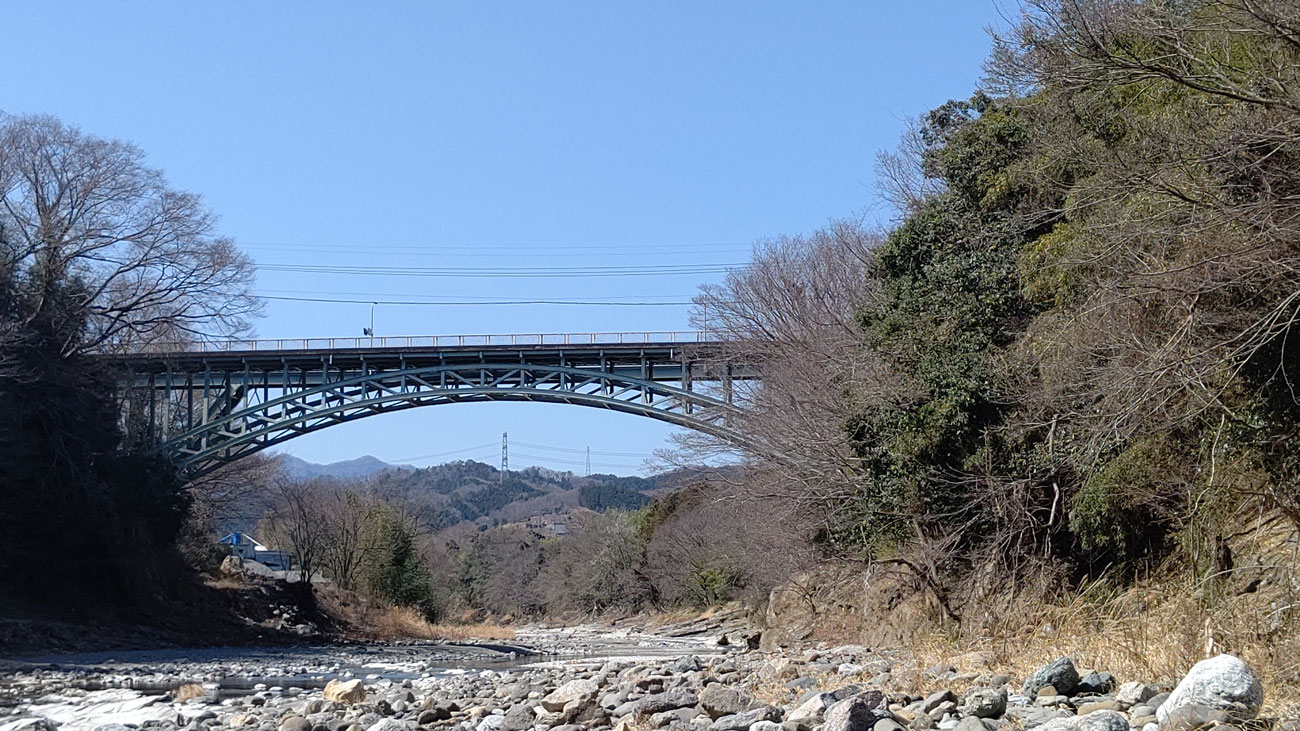
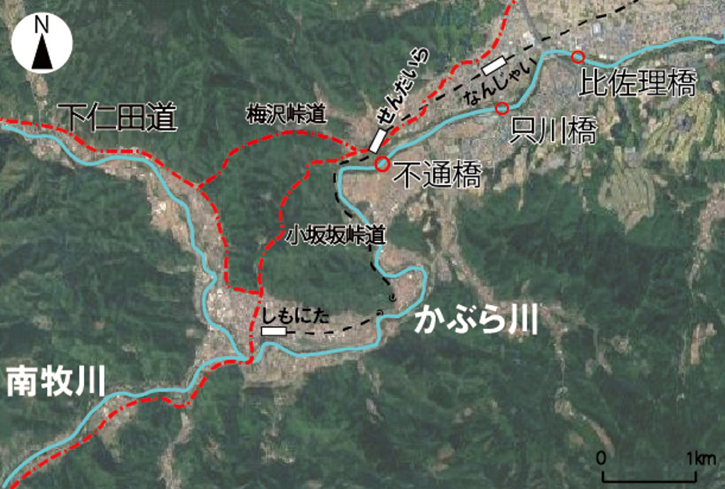
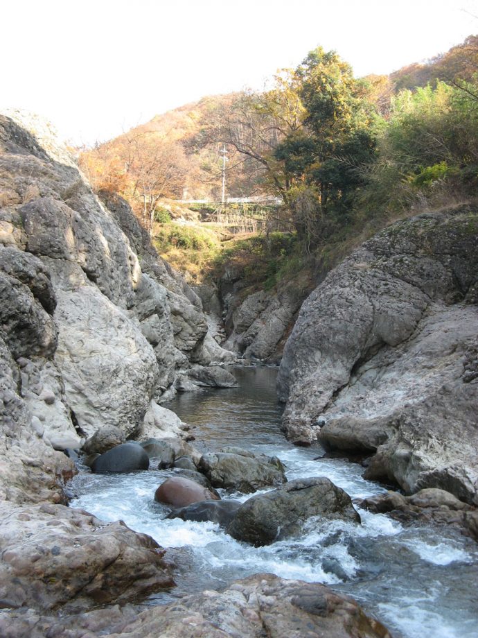
3. Tōrazu Gorge (Futsū Keikoku)
The Tōrazu Bridge, located south of Sendaira Station, offers a clear view of the striking Tōrazu Gorge.
The name “Tōrazu” (“impassable”) is said to come from the days when the Kabura River was used for transport—boats were unable to pass through this rugged part of the gorge.
Upriver from the bridge, cliffs around 20 meters tall stretch for 500 meters, forming one of Shimonita’s scenic highlights. The rock walls are composed of mudstone and sandstone of the Nanjai Formation, as well as extremely hard conglomerate of the Kanohara Formation.
Above the cliffs are flat, wide fields, which sit on river terraces formed by the Kabura River. These terraces are remnants of a time when the river frequently flooded during glacial periods tens of thousands of years ago.
The gorge as we see it today began to be carved around 10,000 years ago.
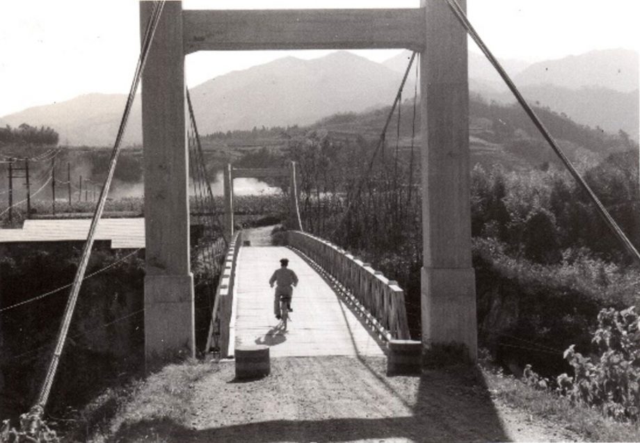
Tōrazu Bridge and Tōrazu Gorge
Around 1955 – The Suspension Bridge at Tōrazu
4. Lower River Terraces
Lower River Terraces
Along National Route 254, which runs parallel to the Kabura River, you can find a series of lower river terraces. Around 30,000 years ago, during the Late Pleistocene, the Kabura River flowed at this elevation. Repeated flooding events carried mud and sand that gradually filled in the area, creating the broad, flat surfaces of the terraces.
Terrace Gravel Layers
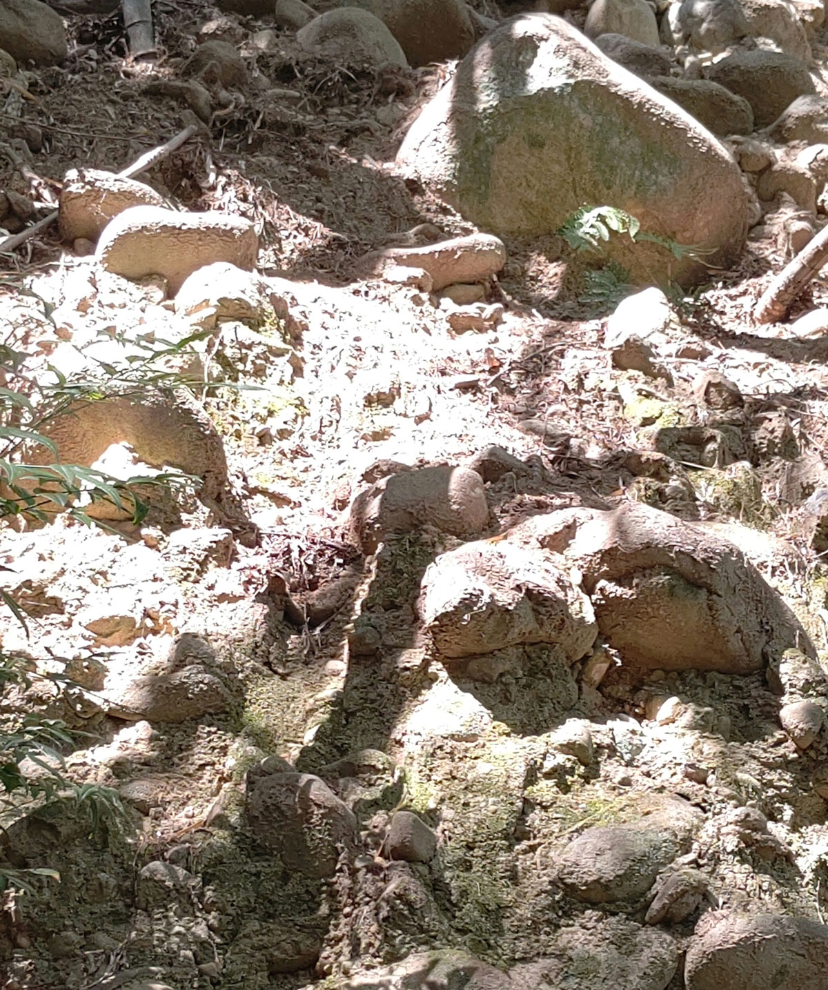
Terrace Gravel Layer at the Confluence of the Yokose and Kabura Rivers
These geological layers contain rounded stones, which became smooth as they were transported by the river in ancient times. This tells us that the terraces were originally riverbeds, flattened over time by the river’s erosive forces.
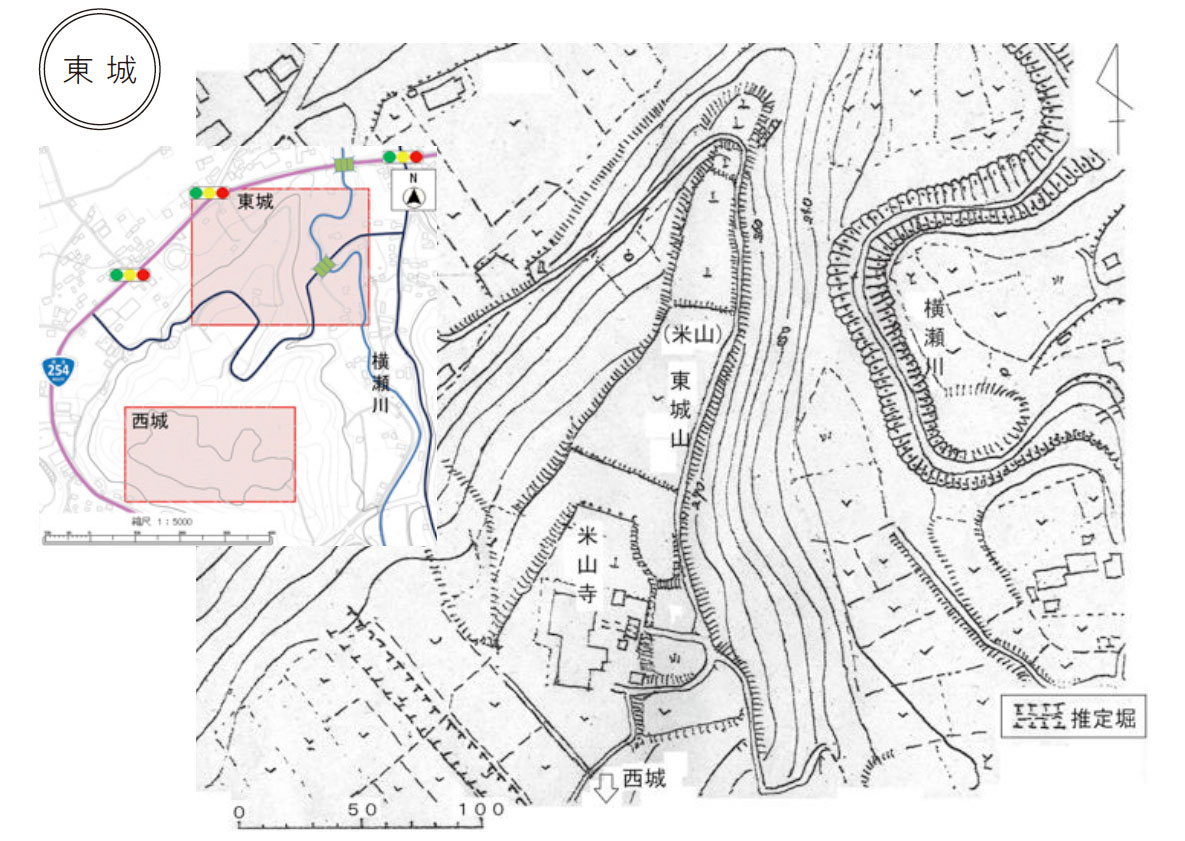
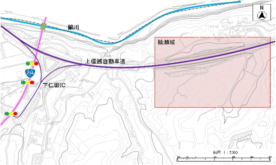
Topography of Mayama and the Remains of a Mountain Castle
In the southern part of the Mayama area lie mountains such as Mount Kurouchi and Mount Inafukumi, which are part of the Kanto Mountains.
The tributaries of the Kabura River, flowing from the south to the north, cut across these terraces, leaving isolated hills scattered across the Mayama region.
These vantage points, offering clear views of the surrounding area, were ideal locations for mountain castles during the Warring States period.
Among them, Higashi-Mayama Castle was a natural fortress, protected by a steep river terrace cliff formed by the Kabura River to the north and another cliff carved by the Yokose River to the east.
Map data sourced from the Geospatial Information Authority of Japan (GSI).
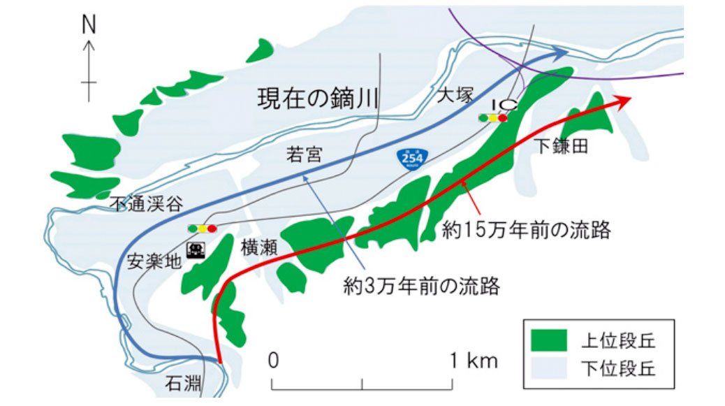
Shifting Course of the Kabura River
Around 150,000 years ago, when the upper terraces were formed, the Kabura River flowed straight northeast from around the Ishibuchi area through Yokose to Shimokamata.
By about 30,000 years ago, when the lower terraces began to form, the river had shifted course, flowing through Anrakuji, Wakamiya, and Ōtsuka.
Around 10,000 years ago, it moved even farther north to its present-day location, where it began carving out a new valley.
The Tōrazu Valley and the upstream Hanekoshi Gorge were formed during this time.
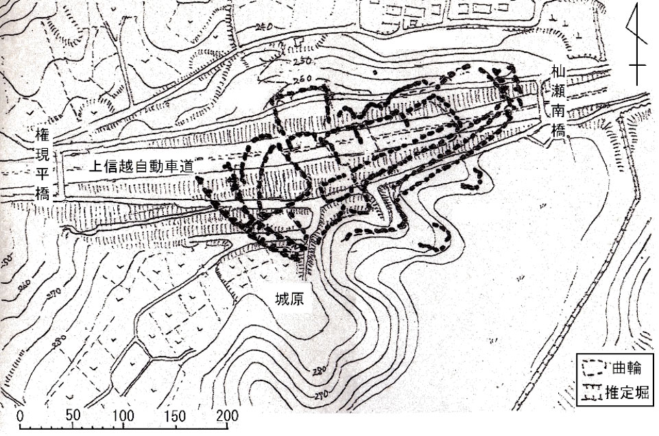
5. Ruins of Mayama East Castle and West Castle
East Castle
This narrow, elongated castle site protrudes about 300 meters northeast from Beisanji Temple, in a beak-like shape. The current access route from the roadside station (Michi-no-Eki) area is believed to be the main gate approach. The main enclosure (honmaru) is thought to have been located where Beisanji Temple now stands.
Situated on a terrace with excellent visibility, it formed the core of the fortification. Along with Mayama West Castle, located approximately 400 meters away, it is considered to constitute a pair-castle layout, functioning as a single strategic complex.
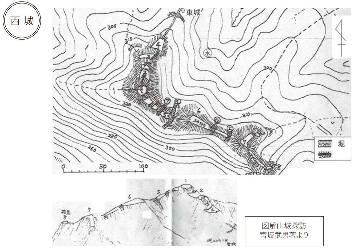
West Castle
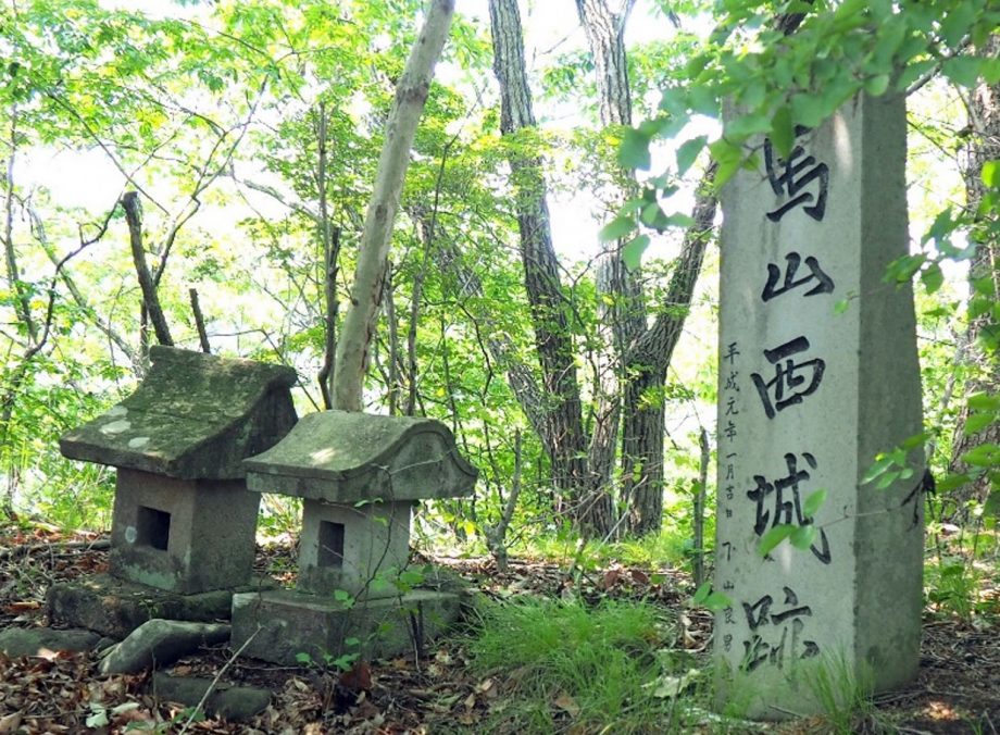
Located on the rear mountain behind the East Castle, the West Castle was developed as a functional wartime fortress. It was designed to defend the main enclosure, serve as a lookout, and act as a final stronghold.
The site stretches about 350 meters in length, with the main enclosure at the western edge of the summit. Sitting atop a steep cliff 110 meters above the Kabura River, it is at an elevation of 334 meters.
6. Beisanji Temple
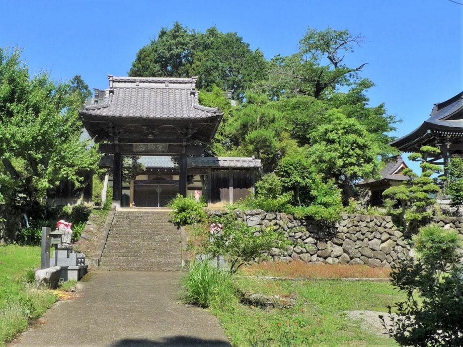
Beisan Iō-in Beisanji Temple is one of the three temples named “Beisan” along with Echigo Yoneyama (in present-day Niigata Prefecture).
It was founded in 1337 (Engen 2), and the principal image is Yakushi Nyorai (the Medicine Buddha), said to be crafted by the monk Jikaku Daishi (Ennin). The temple is believed to grant blessings related to health and medicine.
It belongs to the Tendai sect, and its treasured possession is the complete collection of the Daihannyakyō Sutra (Great Perfection of Wisdom Sutra).
Yoneyama Archaeological Site
On the upper terrace surrounding Beisanji Temple, archaeological remains from the Paleolithic to Yayoi periods and the Warring States period have been found, collectively known as the Yoneyama Archaeological Site.
In a 2008 (Heisei 20) excavation conducted prior to construction of the agricultural bypass road, remains of a settlement from the late Early to Middle Jōmon period (about 5,000 years ago) were discovered, along with numerous pieces of Jōmon pottery and stone tools.
7. Shimonita Loam Layer on the Upper Terrace
The upper terrace where Beisanji Temple is located is believed to have formed about 150,000 years ago during the Middle Pleistocene. It continues eastward along the Nōmen Road from the Yokose River, connecting to a gently undulating expanse of farmland, and rises about 80–90 m above the present riverbed.
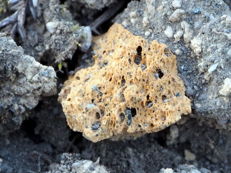
Between Beisanji Temple and the farmland to the west, beneath the surface layer of black soil, the upper to middle layers of the yellowish-brown Shimonita Loam (red soil) can be seen, several meters thick. In spots where the surface of the nearby fields has been slightly eroded, you can find pumice stones originating from Mount Asama. On closer inspection, these pumice stones are porous like a sponge due to their vesicular texture.
Pumice from Mount Asama
Shimonita Loam Visible along the Roadside
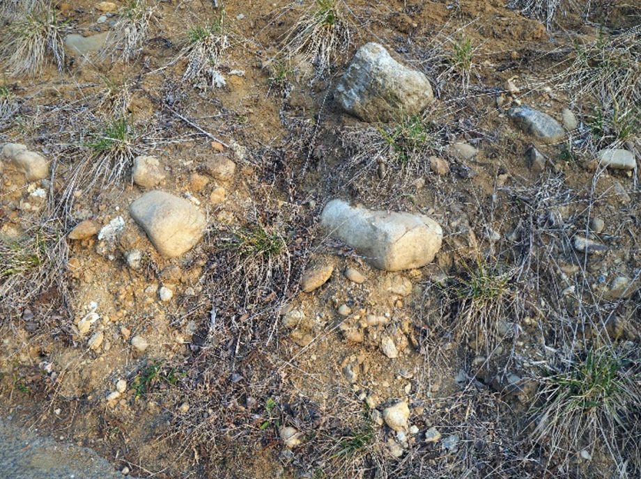
Gravel Layer of the Upper Terrace
These gravels were deposited by the Kabura River about 150,000 years ago when this area was once its riverbed.
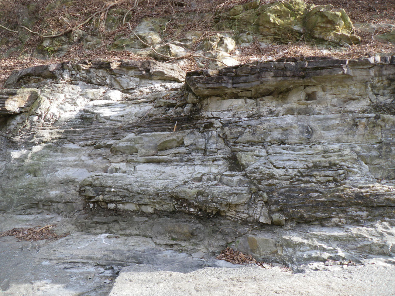
8. Outcrop of the Tomioka Group
Near the Kabura River, you can see strata where layers of sand and mud alternate.
At outcrops facing the river, the Tomioka Group of the Neogene Period is clearly visible.
Fossils such as shells and shark teeth have been found in these strata, which were deposited in a marine environment about 16 million years ago.
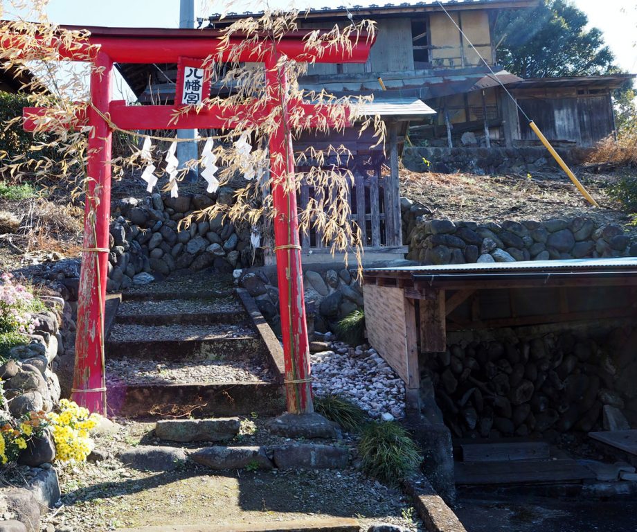
9. Mayama Shrine
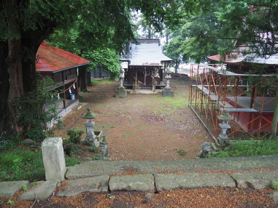
The current main hall of Mayama Shrine was built in 1877 (Meiji 10) when 30 shrines in the village were merged.
The dedication of lion dances from each district is a popular tradition.
The main hall of Mayama Shrine stands at the lowest point within its precincts, an unusual layout similar to that of Nukisaki Shrine in Ichinomiya, Tomioka City.
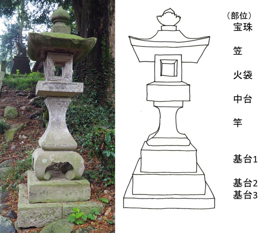
Jōyatō (Night Lanterns)
The Jōyatō stone lanterns are made from different kinds of stone depending on the period in which they were constructed, with sandstone and andesite being the most common.
On some lanterns, the hibukuro (firebox section, third tier from the top) and the shaft (fifth tier) are unusually thin. These parts have sometimes been damaged by earthquakes and later repaired using different stone materials.
Today, Mayama Shrine preserves many Jōyatō lanterns from the Edo period, which have withstood major disasters and remain in their original form since the time they were built.
(Photo: Jōyatō lanterns at Mayama Shrine, left; part names, right)
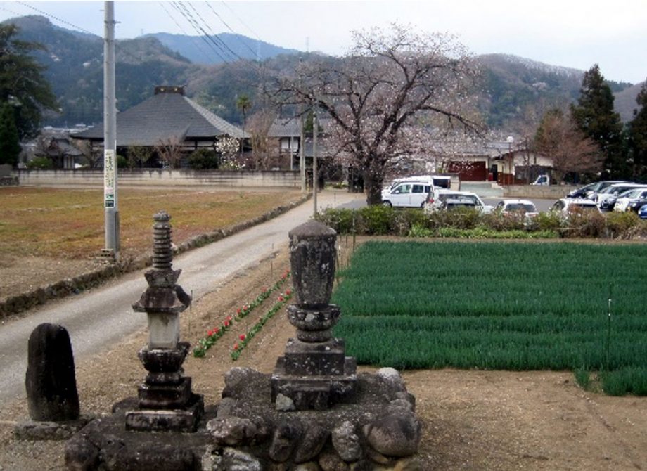
10. Eimeiji Temple
Located in Wakamiya, Eimeiji Temple is a historic temple said to have been founded in 968 (the first year of the Anwa era) by the Buddhist priest Jikei Daishi. Around the 1470s (Bunmei era), it is believed to have been relocated from the site of Maita Fudō Waterfall to its current location. Today, old stone monuments are arranged throughout the temple grounds.
11. Former Sericulture-Related Sites
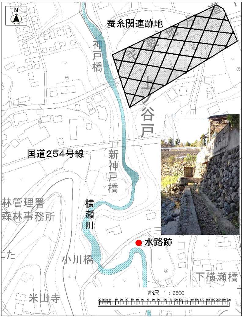
At the confluence of the Kabura and Yokose rivers, mulberry fields spread across a breezy area ideal for producing high-quality mulberry leaves. Silkworms raised on such leaves yielded healthy, disease-resistant eggs, leading to a thriving industry in silkworm egg production. Facilities such as silkworm egg production plants, egg sorting houses, and the Nakahashi Silk Mill of the Mayama Division of Shimonita Company were established here.
Waterwheels served as a power source, and traces of the channels that drew water from the Yokose River for these waterwheels still remain.
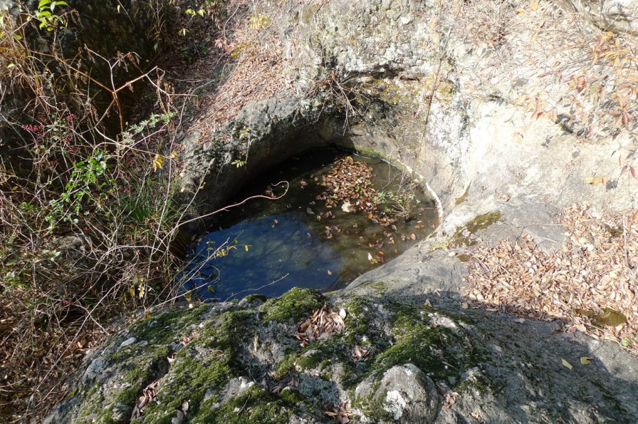
12. Wakamiya Hachimangū Shrine and Wells
Beneath the terrace cliffs lies a layer of river gravel deposits. These consist of small, rounded stones shaped by the river’s flow. Because such ground naturally filters and purifies water, many wells have been dug in the area, providing clear, fresh water.
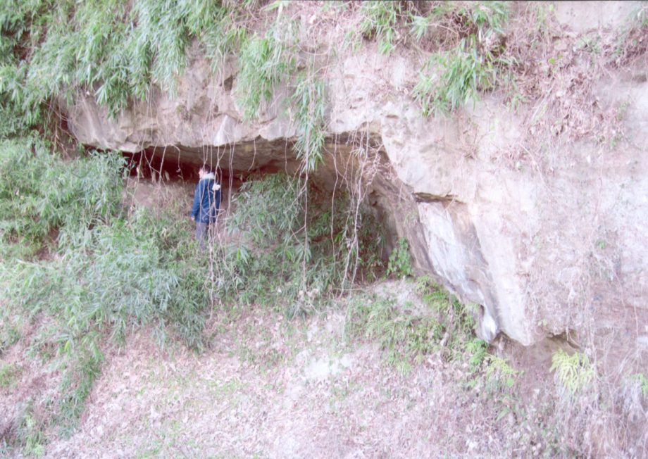
13. Yayoi Cave Burial Site under Tadakawa Bridge
On the right bank of the Kabura River upstream of Tadakawa Bridge, rocks from the Neogene Period can be seen prominently in the terrace cliffs. From a rock shelter (notch) halfway up the cliff, human remains from the late Yayoi period, along with pottery and stone tools, have been discovered.
Note: Access to the river requires crossing private property, so please view the site from the bridge.
Tadakawa Bridge
Constructed in 1931 (Shōwa 6), this bridge originally served as part of National Route 254. Following the construction of the expressway interchange, it was redesignated as Prefectural Route 48. Due to the local topography, it was built as Gunma Prefecture’s first two-hinged steel truss arch bridge, notable for its beautiful structural framework.
It has been recognized as a “Civil Engineering Heritage Site” by the Japan Society of Civil Engineers.
Changes in Transportation in the Mayama Area
The main bridges crossing the Kabura River in the Mayama area are Tōrazubashi, Tadakawa Bridge, and Hisaribashi.
Because the river here is wide and the valley is deep, bridges could only be constructed after civil engineering techniques advanced in the Meiji period. Before then, travelers from Tomioka to Shimonita took the Shimonita Road, a route crossing the mountain passes.
When the Kōzuke Railway opened its entire line between Takasaki and Shimonita in 1897 (Meiji 30), even the railway found it difficult to span the Kabura River, so the line was built along the present-day route at the base of the mountains.
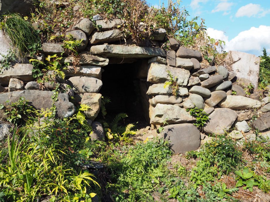
14. Ōtsuka Burial Mound
Large keyhole-shaped mounds (zenpō-kōen-fun) are mostly found in the area around Jōshū-Ichinomiya Station. West of there, almost all kofun are small, round burial mounds (empun).
On the left bank of the Kabura River lies the Nanajai Kofun Group, while the Mayama Kofun Group can be seen on the right bank. In Shimonita Town, this is the only burial mound preserved in a state close to its original form. The name “Ōtsuka” is thought to derive from it.
Note: This site is on private property; please view it from along the roadside.
Mayama Kofun Group
According to a 1938 (Shōwa 13) survey of burial mounds in Gunma Prefecture, around 20 mounds once existed in the Mayama area. Later surveys discovered additional mounds in the Shimokamata and Somaze districts. Today, mounds remain in both Ōtsuka and Somaze.
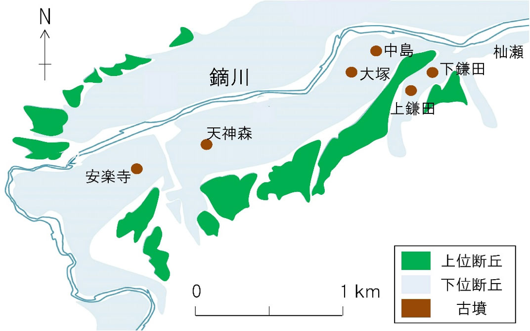
Map of ancient tombs
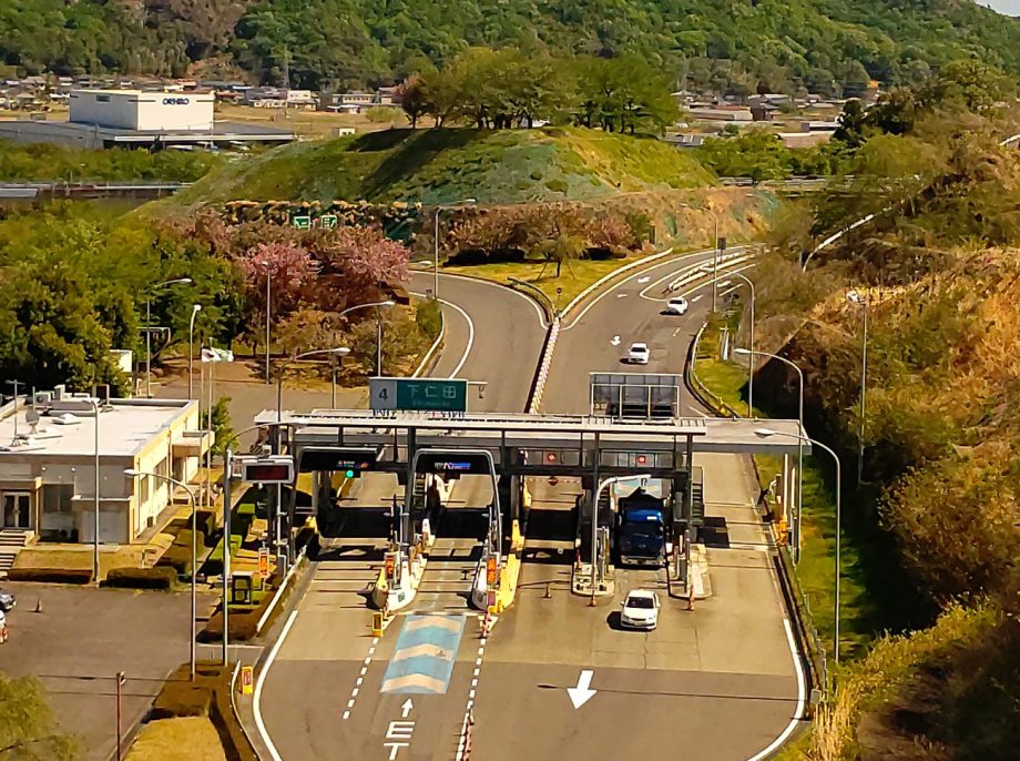
15. Shimonita Interchange and Shimokamata Archaeological Site
Located at the site of the present Shimonita IC, the Shimokamata Archaeological Site was excavated during expressway construction. Remains and artifacts from periods ranging from the Paleolithic to the Middle Ages were uncovered.
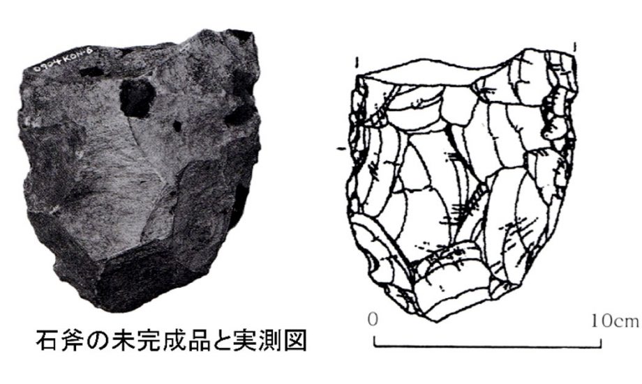
Notably, many pit dwellings from the Middle Jōmon period were identified, revealing that the site had served as a production area for ground stone axes, made using locally sourced stone.
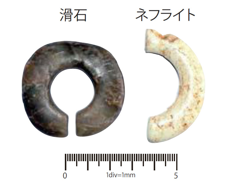
Jewel-Shaped Earrings from Shimokamata
The brown example is a jewel-shaped earring (ketsujō-mimikazari) made from domestically sourced talc. The white, half-broken piece is made of nephrite (soft jade) originating from the Asian continent—a material not found in Japan. A hole drilled at the edge suggests that, after breaking, it was repaired and treasured for continued use.
Dating to the early Jōmon period, around 7,000 years ago, this rare item is considered the earliest form of earrings in Japan, and likely an imported good.
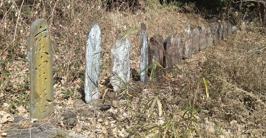
16. Kamata Itabi Stone Monument Group
Originally located along the old road from Mayama to Nogami, the Kamata Itabi group was relocated to a hill south of Shimonita IC when the expressway was built. Most are Kōshin-tō (Kōshin stone monuments) made from green schist and similar stone types. Some stand over four meters tall.
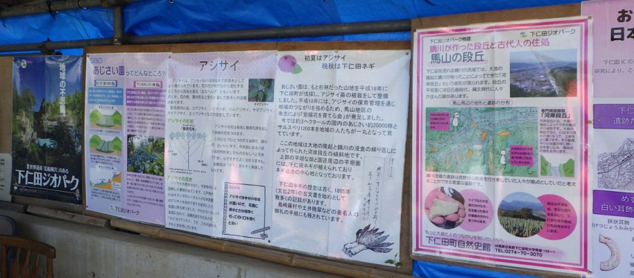
17. Hydrangea Garden
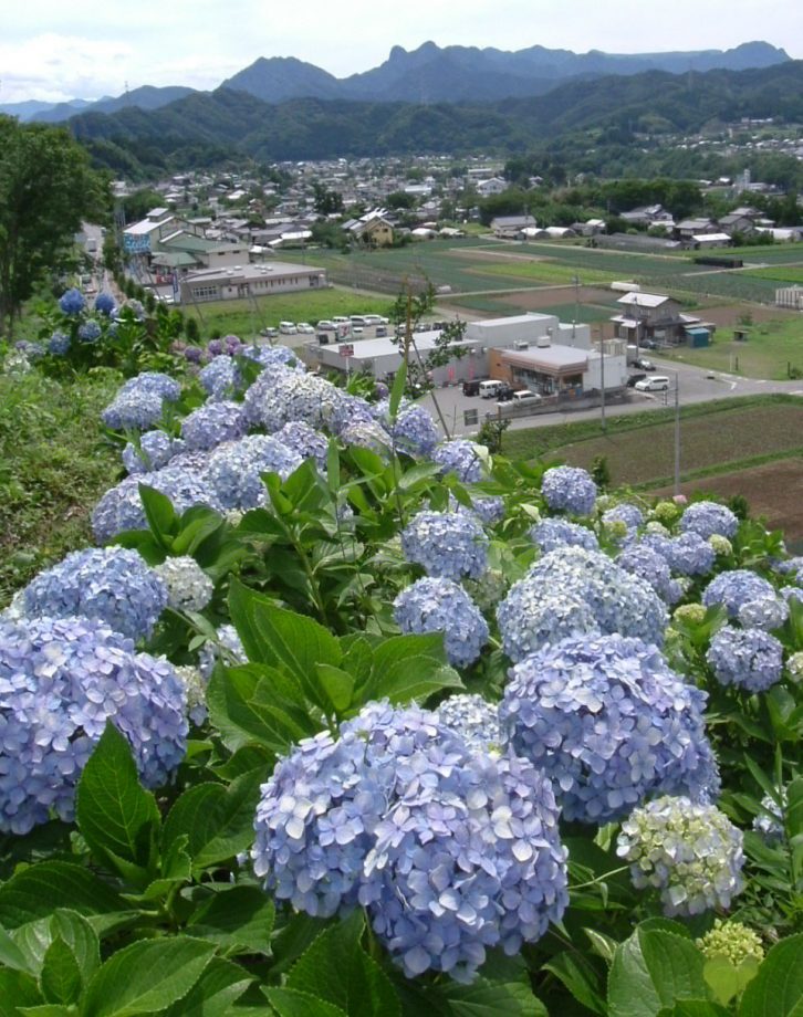
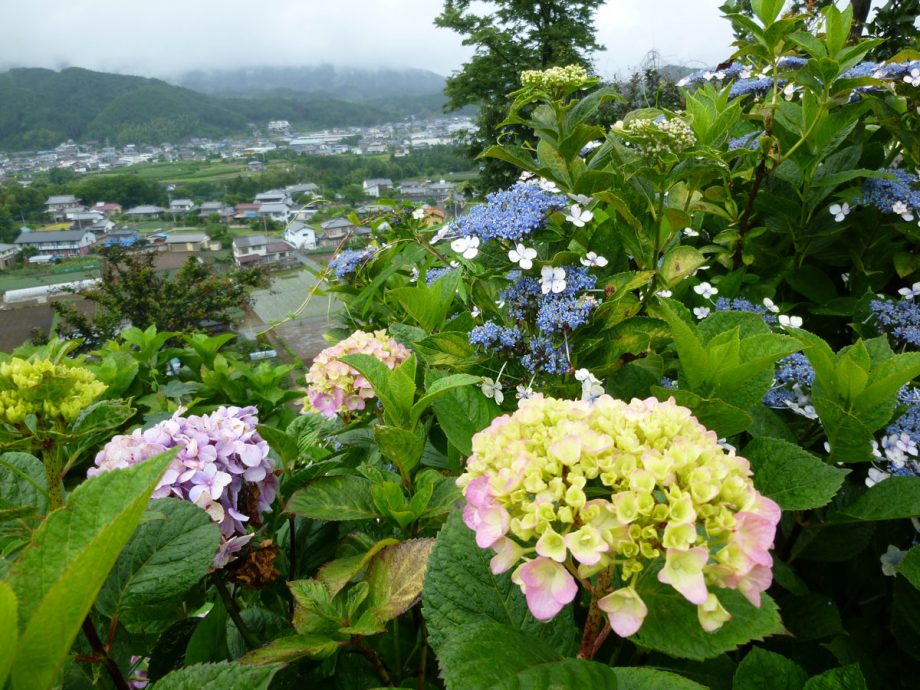
Maintained by the local group “Hydrangea Cultivation Society”, the Mayama Hydrangea Garden boasts about 20,000 hydrangea plants blooming along the terrace cliffs.
Hydrangea Festival
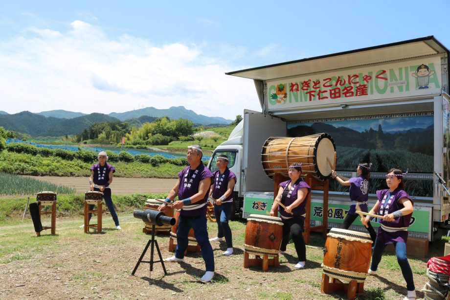
From June to July each year, the Hydrangea Festival draws many visitors from within and outside the prefecture. Members of the cultivation society run stalls and rest areas, creating a lively atmosphere. The Geopark Corner features poster exhibits and guided explanations by Geopark Association members.
18. Archaeological Highway
Along the Nōmen Road on the upper terrace surface of the Mayama Hills, a series of archaeological sites are distributed almost continuously: the Beisan Site, Fujizuka Site, Kannonjibara Site, Nagaone Site, and Shimokamata Site.
In the Jōmon period, people are thought to have lived on elevated hillsides away from the rivers.
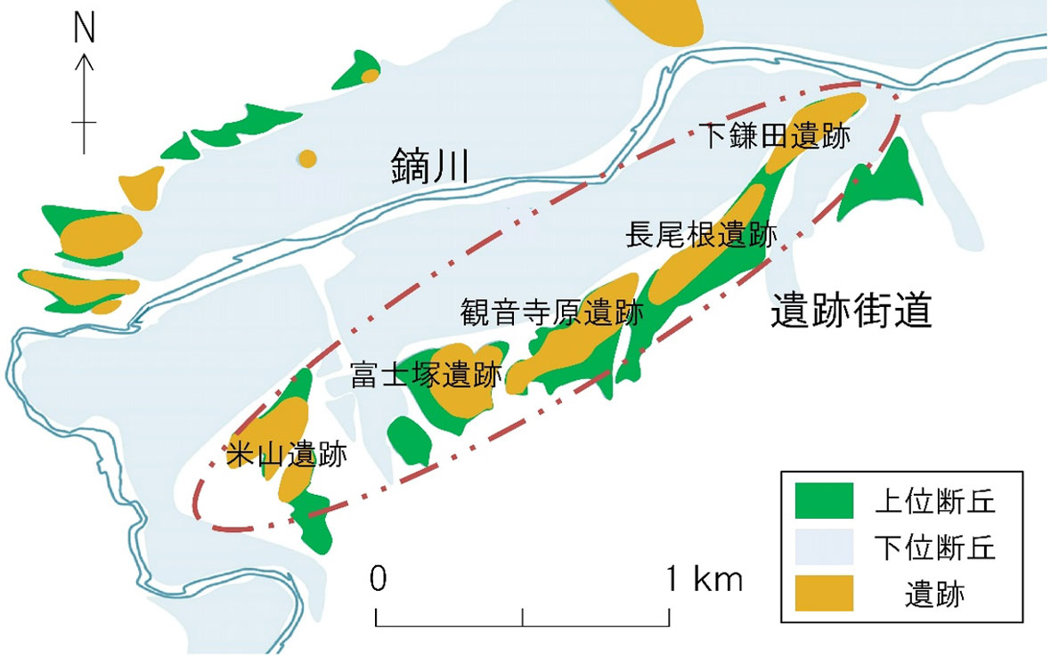
Map of Archaeological Sites (from the Paleolithic to the Jōmon Period)
19. Remains of the Somaze Castle
During the construction of the Joshinetsu Expressway, excavation work was carried out where the site would be cut through.
Remains ranging from Jōmon-period dwellings to a Sengoku-period castle and temple site were discovered. The Jōbara area, located on the highest river terrace surface, offers a magnificent panoramic view.
The site also contains traces of ancient burial mounds, including platy sandstone blocks believed to have been used for the walls of stone burial chambers. The place name “Jōbara” is locally pronounced Jōppara.
20. Gongendaira Bridge
This bridge, which spans the main line of the Joshinetsu Expressway, is named after the small locality (ko-aza) of Gongendaira.
When entering Shimonita Town via the expressway, visitors are greeted by views of Mount Myōgi and, in the distance, the distinctive Mount Arafune — a landscape that evokes the feeling of returning home.
21. Hanekoshi Gorge
At the boundary between the Mayama and Shimonita districts, along National Route 254, the Kabura River flows flanked by continuous 20-meter-high cliffs on both banks. This scenic spot, known as Hanekoshi Gorge, was a bustling destination in the Taishō era, with food stalls set up on the rock surface and a riverside swimming area. A temporary stop for the Jōshin Dentetsu railway once operated here.
Hanekoshi Gorge consists of the Kanohara Conglomerate, a hard rock formation about 70 million years old, containing red-colored clasts that give the entire rock mass a reddish hue. Over time, the river carved this resistant rock into a striking gorge.
Kanohara Conglomerate forming Hanekoshi Gorge
Hanekoshi Gorge and the Pothole of the Urashima Legend
Upstream, on a small terrace about 10 meters above the current riverbed, there is a cylindrical pothole (ōketsu) about 2 meters in diameter and 3 meters deep. It was formed when pebbles, driven by river currents, rotated in place and drilled into the bedrock.
Locally, the deep pool beneath this terrace is called Tarō-buchi, and a folk legend claims that the pothole connects to the Dragon Palace (Ryūgū-jō) from the Urashima story.
22. Maita Fudō-son
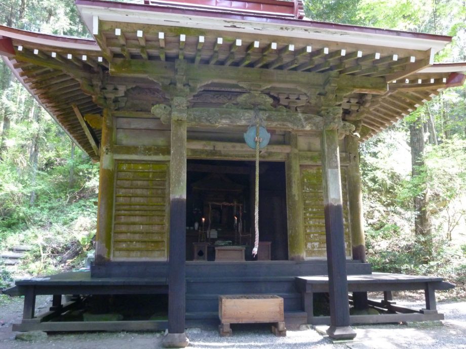
According to tradition, in 968 (Anwa 1), the Buddhist priest Jikei Daishi discovered a waterfall here, built a small hermitage, and enshrined Fudō Myōō (Acala).
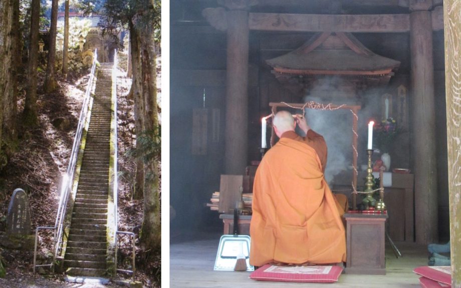
(Left) Stone steps leading to Fudōson / (Right) Fudōson’s public unveiling and Goma fire ritual
Revered as a spiritual focal point for the residents of Maita, it is carefully maintained. Twice a year, on January 28 and April 28, the Fudō-son’s ceremonial unveiling (gokaichō) and Goma fire ritual are performed.
Fudō Waterfall
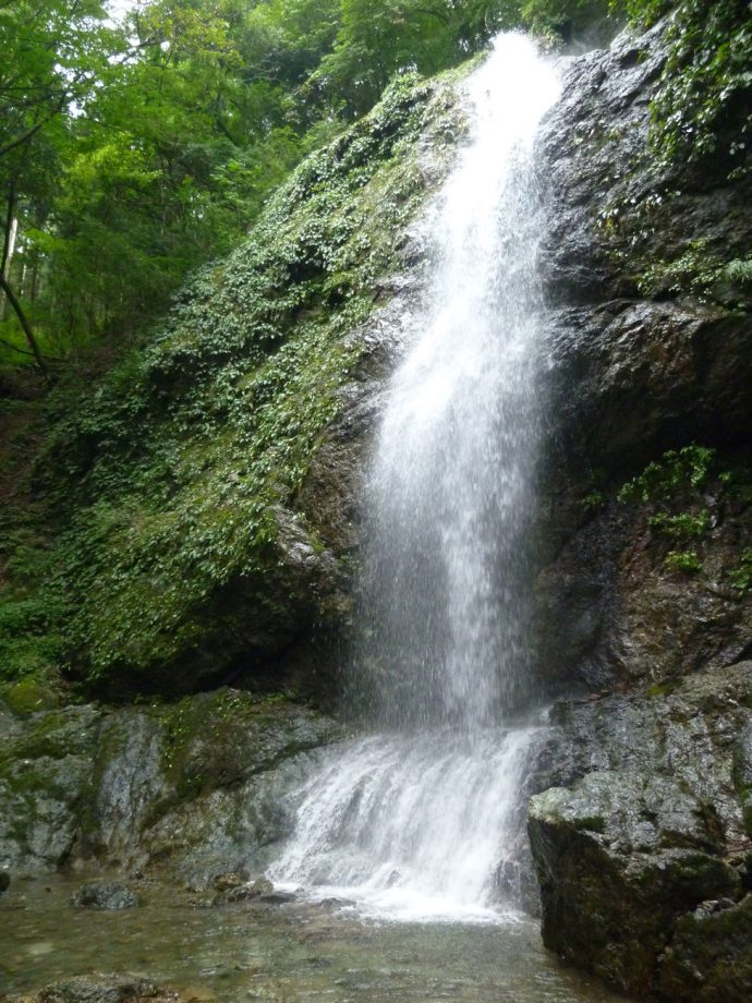
The waterfall, officially named Amanu Falls (Amanu Bakufu), cascades over a cliff of Kawaisan quartz diorite formed about 270 million years ago.
On a rock at the base of the falls stands a small statue of Fudō Myōō, while in a nearby rock cave, Benzaiten is enshrined.
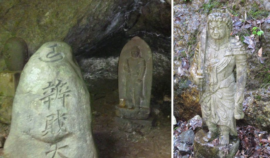
(Left) Benzaiten enshrined in a rock cavity / (Right) Small statue of Fudō Myōō at the base of the waterfall